YOU BRING
3D Seismic data and one or more of the following processed datasets coincident with the survey:
• Magnetic field intensity data;
• Gravity station / gravity gradiometry data;
• Magnetotelluric station data (Full-tensor, broadband preferred);
• Induced polarization data;
• LOTEM;
• CSEM (if applied in a marine setting).
YOU GET
A 3D Geobody Model in any of the following formats:
• 3D UBC mesh and model file format;
• ASCII point cloud;
• DXF files (Geobody).
WE BRING EXPERT HUMANS
• Data Science experts with extensive seismic and minerals exploration experience
• World class technical advisors and industry recognized thought leaders in minerals systems modelling
• Co-located, data science and geoscience teams across acquisition, processing and Interpretation.
WITH EXPERT SYSTEMS
* Automated 3D Geobody Modelling workflows
* HiSeis Proprietary Machine Learning Algorithms
* Multi-physics joint inversion functions
WHAT IS SEISOMICS
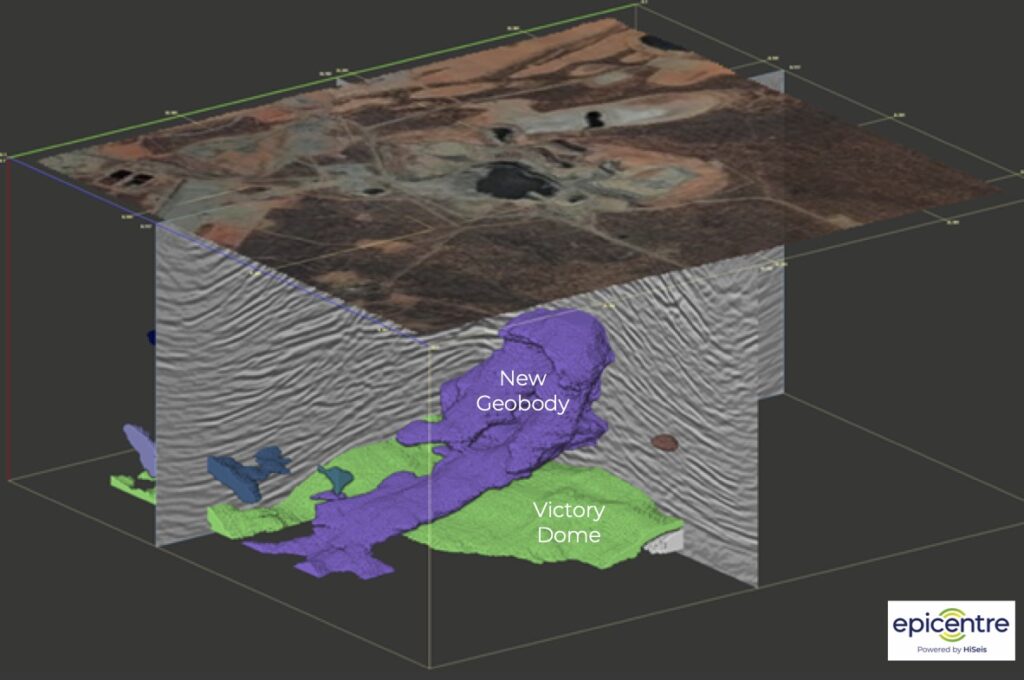
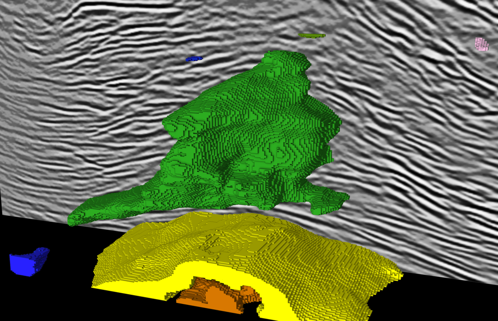
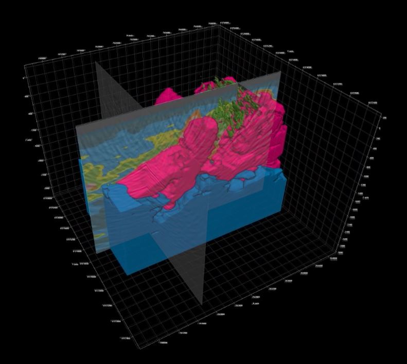
Seisomics is a 3D Geobody Modelling workflow that automatically extracts geological features, such as intrusions, from 3D seismic data using a HiSeis proprietary algorithm in Epicentre. Seisomics leverages unconstrained machine learning to petition seismic volumes into regions of different geological/lithological composition.
WHY THIS IS IMPORTANT FOR EXPLORATION
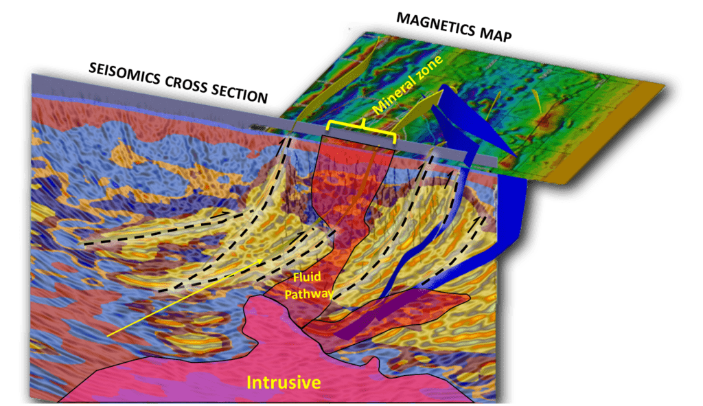
Seisomics is particularly effective in identifying regions of unique textural facies that are often associated with intrusions. These regions can then be brought in as structural constraints within inversion workflows for gravity, magnetics, and electromagnetic methods resulting in better resolved petrophysical properties including density, magnetic susceptibility, and electrical conductivity which can be used to target mineralization with enhanced probability.
Case Studies
How SEISOMICS helps our clients.

Deeper insight into mineral systems
Illuminate intrusive geobodies deep in the earths crust.
We can’t predict your future
but we can help you see underground.
